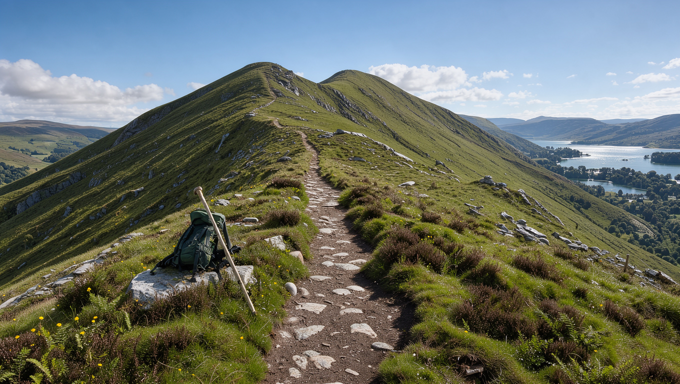
Cat Bells looks like a simple half-day walk, but its start point has very little parking and the sources disagree on how long the round trip takes. This guide lays out the route options, the time estimates and their gaps, and what to plan for before you leave the car.
Summit height: 451 m (Ultra Light Hike route guide) | Keswick to the start: about 4 km each way (Lake District National Park Authority) | Hawes End circular: about 5.6 to 6 km (Ultra Light Hike route guide)
Cat Bells at a glance
Summit
- Summit height of 451 m, per the Ultra Light Hike route guide, which cites three matching sources.
Keswick link
- About 4 km each way from Keswick to the start, mainly on public footpaths, per the Lake District National Park Authority guidance on getting to Cat Bells.
Hawes End circular
- About 2 to 3 hours at average fitness, per the Ultra Light Hike route guide, a tier 3 source.
Parking
- Keswick Launch Park and Sail gives 15% off launch tickets when you park at Keswick Rugby Club, per the Lake District National Park Authority.
The table below separates figures confirmed by the official park site from single-source estimates.
| Fact | Value | Source tier |
|---|---|---|
| Summit height | 451 m | Tier 3, three sources agree |
| Keswick to Cat Bells start | About 4 km each way | Tier 1, official park |
| Park and Sail discount | 15% off launch tickets | Tier 1, official park |
| Hawes End circular time | 2 to 3 hours (sources range 1¾ to 4 hours) | Tier 3 |
| Rugby Club parking capacity | Around 200 spaces | Tier 3, one source |
How long does it take to walk Catbells?
Estimates for the Hawes End circular run from about 1¾ to 2½ hours at a fast-to-steady pace, according to hikes.guide’s Cat Bells route page, a medium-confidence tier 3 source. TheLakeDistrict.org puts the total at about 3 hours, and Countryfile’s 3.6-mile moderate route takes about 2.5 hours. Travel Hacker Girl gives 2.5 to 3.5 hours, and Mountains Not Molehills rates its 6-mile circular at 3 to 3.5 hours, a low-confidence figure.
Pace, stops and weather all change the total. The listed times are estimates, not timed walks.
Four of the six time ranges include three hours, so plan for three hours and add time for a long lunch on the summit.
Which is the easiest route up Catbells?
The two options in the evidence are the Hawes End circular and the walk from Little Town via Hause Gate. The table compares their distance, climb and time as reported by each source.
| Route | Distance | Ascent | Time | Rating |
|---|---|---|---|---|
| Hawes End circular (hikes.guide) | 5.67 km | 407 m | 1¾ to 2½ hours | Not rated |
| Countryfile 3.6-mile route | About 5.8 km | 435 m | About 2.5 hours | Moderate |
| Little Town via Hause Gate | 5.2 km | 342 m | About 2 hours | Easy (low confidence) |
| Gutherscale start (Walking Britain) | 6.5 km | 455 m | 3 hours 20 minutes | Easy to moderate (low confidence) |
The Little Town route is rated easy by Walking Englishman, but that rating comes from one tier 3 source with low confidence. The Hawes End route is the one with the most sources behind its figures.
Upsides and downsides
Upsides
- Hawes End has the most consistent figures across sources.
- Little Town is rated easy and needs less climbing.
Downsides
- The pull onto Catbells is short and steep, about 36% over its steepest 250 m, according to hikes.guide’s ridge route notes.
- Little Town’s easy rating rests on one low-confidence source.
The gentlest approach on the evidence is Little Town, but the Hawes End route is the better-documented choice for planning.
Where can I park when walking the Catbells Walk?
Where do you start Catbells?
Hawes End is the main trailhead on the western shore of Derwentwater, and its roadside parking is small. Some guides name Gutherscale and the Skelgill Bank north car park as alternative starts, but those car park details are not confirmed against an official source.
Can you walk from Keswick to Catbells?
Yes. The Lake District National Park Authority puts the shortest walk from Keswick at about 4 km each way. Keswick Launch also runs a direct walkers’ launch at 9.45 each morning, according to Countryfile’s walk guide, a medium-confidence source.
Cat Bells is one of the Lake District’s most popular fells meaning it does get busy and parking is extremely limited at the start of the walk.
Lake District National Park Authority, official park website
Please don’t be tempted to park on double yellow lines, you may stop emergency services getting through and you will be fined.
Lake District National Park Authority, official park website
A full roadside at Hawes End is a reason to change plans, not a reason to park on double yellow lines.
The implication: a Keswick Launch booking removes the roadside gamble, and the 9.45 walkers’ departure gives a fixed start time to plan around.
Is Catbells ok for beginners?
At 451 m, Cat Bells is lower than many Lake District fells. Wainwright described it as a family fell, writing that “grandmothers and infants can climb the heights together,” as quoted by Countryfile. TheLakeDistrict.org grades the walk medium difficulty, suitable for adults with moderate fitness and older children.
It is one of the great favourites, a family fell where grandmothers and infants can climb the heights together, a place beloved.
Alfred Wainwright, as quoted by Countryfile
Is Catbells a hard walk?
The walk is rated medium difficulty, and TheLakeDistrict.org’s walking guide warns of a short scramble over rocks near the summit that some beginners may find intimidating. Rock steps are slippery when wet, so boots or grippy shoes are the consistent advice across sources.
If you are unsure about the scramble, turn back at the rock steps. The ridge does not require the summit to enjoy the walk.
Are Catbells ok for kids?
Travel Hacker Girl suggests the classic first fell suits children around age 5 and over who already walk well, and notes the ridge is not pushchair-friendly. Mountains Not Molehills calls the walk family friendly but not suitable for pushchairs.
Parkwolf advises carrying water, food and waterproof and warm layers, because there are no dependable facilities on the summit.
Can you provide a map of the Catbells circular walk route?
This guide does not embed a map, because the research did not confirm an official map source for the circular. Use the Lake District National Park Authority page to check the start and access points before you go. The main ridge path is described as clear in good weather, while hikes.guide rates navigation as moderate in cloud, a low-confidence rating. Parkwolf asks walkers to keep to the main path up the nose of the ridge, since shortcuts add to erosion.
Choosing your start
Map your day around the start you can actually reach. Keep the three checks below in order.
- Confirm whether you will drive to Hawes End or book Keswick Launch Park and Sail at the Rugby Club.
- If you take the launch, plan for the 9.45 walkers’ departure.
- Pack water, food, and waterproof and warm layers for the full climb.
- Wear boots or grippy shoes for the wet rock steps.
- Check the weather, because cloud makes the ridge harder to navigate.
Confirmed and unclear
Confirmed: Parking at the start is very limited, and the Park and Sail discount is 15%. The summit is 451 m.
Unclear: Hawes End car park opening days, the seasonal bus timetable, the name origin of Catbells, a reliable child-suitability rating, and a time estimate that all sources agree on.
Keswick Launch’s Park and Sail option lets families avoid the roadside parking gamble at Hawes End, so build it into the plan if you cannot count on a space.
thelakesplanner.co.uk, livefortheoutdoors.com, campingadventures.co.uk, tripadvisor.ie, castlerigg.co.uk, anadventurousworld.com
Frequently Asked Questions
How high is Catbells?
The summit is 451 m, according to the Ultra Light Hike route guide, a tier 3 source that cites three matching sources.
Why is the mountain called Catbells?
The research notes do not explain the name, so this guide does not offer an origin.
What should I bring on a Catbells walk?
Carry water, food, and waterproof and warm layers, plus boots or grippy shoes for the rock steps. Parkwolf lists the same kit.
Is the ridge hard to navigate in cloud?
hikes.guide rates navigation as moderate in cloud, while describing the main ridge path as clear in good weather. This is a low-confidence rating.
Is there a bus to Catbells?
Several guides mention a seasonal bus, including the Honister Rambler and 77/77A services. The timetable has not been checked against an official source, so confirm it before you travel.
Is the Hawes End car park open all year?
One source references Hawes End field car park opening days, but the official car parks page did not confirm them. Check before you travel.
Related stories





Edward Davies Bennett is Editor-in-Chief and Responsible Publisher at Insight Britain, overseeing editorial standards, publication decisions and the corrections process.