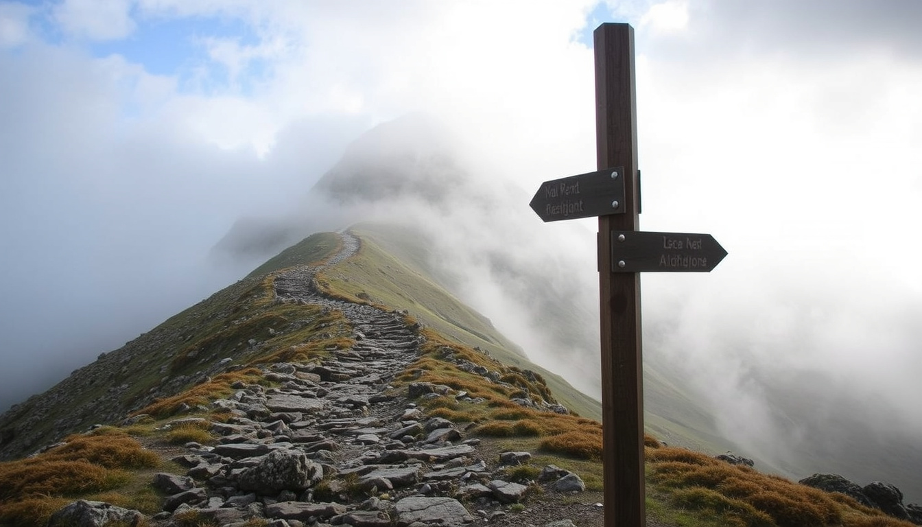
Ben Nevis draws around 150,000 walkers each year as the highest mountain in the British Isles, yet its 1,345-metre summit feels intimidating to beginners. This guide breaks down what you actually need to know to plan a safe and enjoyable climb, using official guidance from Mountaineering Scotland and other verified sources.
Height: 1,345 m (4,413 ft) ·
Location: Scottish Highlands, near Fort William ·
Annual Climbers: Approximately 150,000 ·
Standard Route: Mountain Path (Tourist Track), about 16 km (10 miles) round trip ·
Typical Ascent Time: 7–9 hours round trip
Quick snapshot
- 1,345 m (4,413 ft) – highest in the British Isles (Mountaineering Scotland)
- Scottish Highlands, near Fort William (Mountaineering Scotland)
- Mountain Path (Tourist Track), 16 km round trip, 7–9 hours (Outdoor Scot hiking guide)
- Main season: May to September; winter requires ice axe and crampons (Mountaineering Scotland)
Six key details, one takeaway: Ben Nevis is a serious mountain despite its popularity. The table below compiles the verified facts every climber should know.
| Fact | Value | Source |
|---|---|---|
| Height | 1,345 m (4,413 ft) | Mountaineering Scotland |
| Location | Lochaber, Scottish Highlands | Mountaineering Scotland |
| Nearest Town | Fort William | Mountaineering Scotland |
| Standard Route Length | About 16 km round trip | Outdoor Scot hiking guide |
| Typical Round Trip Time | 7–9 hours | Outdoor Scot hiking guide |
How long will it take to walk up Ben Nevis?
Mountain Path (Tourist Track) estimate
- The standard route – the Mountain Path, also known as the Pony Track or Tourist Track – is about 9 km each way with 1,344 m of ascent (Outdoor Scot hiking guide).
- Most walkers complete the round trip in 7 to 9 hours, with ascent alone taking 4–5 hours (Outdoor Scot).
For a beginner, a 9-hour round trip is a full day’s exertion. Plan to start by 8–9am at the latest to avoid descending in fading light.
Factors affecting time
- Fitness level: even fit beginners should budget 9 hours, not 7.
- Weather: rain, wind or low cloud can add an hour or more to navigation.
- Stops: food, photos, and rest breaks. Most guides recommend carrying at least 1.5 litres of water per person.
- Navigation: the summit plateau is notoriously difficult to navigate in fog; factoring time to stop and check bearings is wise (Raw Adventures).
The implication: the 7–9 hour range is realistic only for prepared walkers on a good day. Beginners should treat the upper end as the baseline.
Is Ben Nevis a difficult hike?
Difficulty grade for the Mountain Path
- Mountaineering Scotland grades the Mountain Path as strenuous but not technical – no scrambling or climbing is required (Mountaineering Scotland).
- Love From Scotland, a first-timer guide, says the route “is suitable for fit beginners but is not an easy walk” (Love From Scotland travel guide).
Physical demands and terrain
- The path is a well-trodden but rocky trail with a steady gradient, crossing several stiles and zig-zagging through woodland in the lower section (Climb Ben Nevis route guide).
- The upper half is loose scree and boulders; the summit plateau is a wide, flat area with cliffs on the northern and north-eastern sides (Outdoor Scot).
Risks: weather, navigation, altitude
- Weather can change rapidly: even in summer, summit temperatures can drop to near freezing with strong winds.
- Navigation: the summit area is very hard to navigate in fog; walkers must carry a compass and know the descent bearing before starting (Outdoor Scot safety advice).
- Avalanche danger: Red Burn is an avalanche hazard when snow is present (Mountaineering Scotland).
- Five Finger Gully has deceivingly gentle upper slopes and has been the site of many accidents (Mountaineering Scotland).
The catch: difficulty isn’t about steep rock – it’s about a long day on rough ground in unpredictable mountain weather. The biggest risk is route-finding failure on the summit plateau.
Can a beginner climb Ben Nevis?
Prerequisites for beginners
- Yes, beginners can climb Ben Nevis with proper preparation. Multiple guides agree the Mountain Track is the best route for those new to hillwalking (Raw Adventures beginner guide).
- Prerequisites: a good baseline of fitness (able to walk uphill for 4–5 hours without stopping), sturdy waterproof boots, warm and waterproof clothing, map, compass, headtorch, food, and at least 1.5 litres of water.
Recommended preparation and training
- Start with shorter, lower-level hikes (e.g., local hills with 500–800 m ascent) to build leg strength and confidence.
- Practice using a map and compass – the summit plateau requires a bearing of 231 degrees for 150 metres from the summit cairn, then 282 degrees to reach the zig-zags (Mountaineering Scotland).
- Tell someone your route, expected finish time, and what to do if you don’t return (Ben Nevis Guest House safety guide).
A fit beginner with good boots, a compass, and realistic expectations can summit safely. The key is preparation, not previous experience.
Guided vs solo for first-timers
- Guided groups are recommended for the inexperienced: a qualified mountain leader handles navigation, pace, and group safety. Several outdoor companies operate guided Ben Nevis walks.
- Solo is possible for prepared beginners who have studied the route and checked weather, but the safety leaflet from High Life Highland advises walkers to keep to the main route and return by the correct path from the summit.
The catch: going solo saves money but raises the consequence of a wrong turn. For a first ascent, a guided day is the safer choice.
Which is harder, Snowdon or Ben Nevis?
Three dimensions separate these two iconic hikes. The table below shows the numbers side by side.
| Metric | Ben Nevis | Snowdon |
|---|---|---|
| Height | 1,345 m (4,413 ft) | 1,085 m (3,560 ft) |
| Round trip distance (easiest route) | ~16 km (10 miles) | ~11 km (7 miles) via Llanberis Path |
| Total ascent | ~1,344 m | ~975 m |
| Technical difficulty (easiest route) | Strenuous but non-technical | Moderate, some rocky sections |
| Typical time | 7–9 hours | 5–7 hours |
| Summit terrain hazard | Cliffs on N & NE; difficult navigation in fog | Built-up summit with cafe; fewer navigation traps |
Height and distance comparison
- Ben Nevis is 260 m higher and 5 km longer than Snowdon’s Llanberis Path – a substantially bigger day out.
Technical difficulty
- Both mountains offer non-technical routes, but Ben Nevis’s sustained gradient and loose scree make it more physically demanding.
Typical conditions and weather impact
- Snowdon’s lower height and more sheltered valleys mean weather is often slightly less severe, though both are subject to rapid change.
- Navigation on Snowdon is easier because of the railway path and busy trails; Ben Nevis’s summit plateau is a known navigation trap.
The pattern: for a beginner, Ben Nevis is the harder mountain because of its length, ascent, and summit navigation risk. Snowdon is a better first 1,000+ m mountain.
What town is nearest to Ben Nevis?
Fort William as the gateway town
- Fort William is the closest town, located about 2 km from the Ben Nevis Visitor Centre at the mountain’s base (Mountaineering Scotland).
- The visitor centre has free parking (though it fills early), toilets, and a café. See the High Life Highland visitor page for live parking info.
Accommodation and services in Fort William
- Fort William offers hostels, B&Bs, hotels, camping, grocery shops, outdoor gear stores, and several restaurants – everything a walker needs before and after the climb.
- The nearest airport is Inverness Airport (about 2 hours’ drive) or Glasgow Airport (about 2.5 hours). No direct train from either, but buses and car hire are available.
- Public toilets: there are toilets at the visitor centre (free) and in Fort William. On the mountain, there are no facilities – plan accordingly.
What this means: Fort William is not just the nearest town; it’s the logistic hub for a Ben Nevis climb. Book accommodation well ahead in peak season (May–September).
How to prepare for climbing Ben Nevis (step by step)
- Check the weather – use the Mountain Weather Information Service (MWIS) for Ben Nevis. If high winds or heavy rain are forecast, postpone.
- Pack the essentials: map (OS 392), compass, headtorch with spare batteries, waterproof jacket and trousers, warm mid-layer, hat, gloves, food, water (1.5L minimum), sunscreen, first-aid kit, and a fully charged phone (signal is patchy).
- Plan your navigation – study the route beforehand. Print the descent bearings: 231° for 150 m from the summit cairn, then 282° to the zig-zags (Mountaineering Scotland).
- Share your plan – tell someone your start time, route, expected return, and what to do if you’re overdue (Ben Nevis Guest House safety guide).
- Start early – aim to be on the trail by 8am to avoid descending in the dark. The round trip takes 7–9 hours (Outdoor Scot).
- Keep to the main path at all times – especially on the summit plateau, where cliff edges are unmarked (High Life Highland safety leaflet).
- In an emergency, dial 999 and ask for Mountain Rescue (Ben Nevis Guest House safety guide).
The trade-off: preparation takes real effort, but skipping any of these steps can turn a memorable day into a dangerous one.
Confirmed facts and what’s unclear
Confirmed facts
- Height: 1,345 m (4,413 ft) – verified by Mountaineering Scotland.
- Standard route (Mountain Track) length: about 16 km round trip – verified by Outdoor Scot hiking guide.
- Round trip time: 7–9 hours for prepared walkers – Outdoor Scot hiking guide.
- Nearest town: Fort William, about 2 km from the visitor centre.
- Summit navigation: walk 150 m on bearing 231°, then 282° – Mountaineering Scotland.
- Emergency number: 999 for Mountain Rescue – Ben Nevis Guest House safety guide.
- Five Finger Gully is a known accident site – Mountaineering Scotland.
- Red Burn is an avalanche hazard area when snow is present – Mountaineering Scotland.
What’s unclear
- The exact etymology of the Gaelic “Beinn Nibheis” remains debated; some suggest “venomous mountain”, others “mountain with its head in the clouds”.
- Official annual visitor counts vary between 120,000 and 150,000; the figure of “approx 150,000” is widely cited but not precisely audited.
Quotes from the experts
“Ben Nevis is Scotland’s iconic mountain. The Mountain Path is the most popular route and suitable for walkers with a reasonable level of fitness.”
“The ascent of Ben Nevis by the Mountain Track is straightforward, if strenuous. The key is navigation on the plateau – many accidents happen because people lose their way in the mist.”
“This is a long, hard day. Don’t underestimate it. Start early, take plenty of food and water, and if the weather looks bad, turn back – the mountain will still be there tomorrow.”
Outdoor Scot – Scottish hiking guide
For a beginner planning their first Ben Nevis climb, the choice is clear: prepare deliberately, respect the mountain’s weather and plateau hazards, and either join a guided group or train thoroughly on smaller hills first. The reward – standing on the UK’s highest summit – is unmatched. But the price of underestimation can be high. Climbing Mount Kilimanjaro: Difficulty, Deaths, and Beginner Tips and Faroe Islands Travel Guide 2026: Costs & Tips offer related reading for other big adventures.
reddit.com, scotlandlessexplored.com, indefinitetravel.com, globalsummitguide.com, explore-share.com, gegenblick.de
If you’re looking for more detail on the route and safety, the complete Ben Nevis climbing guide provides step-by-step guidance.
Frequently asked questions
Do I need a guide to climb Ben Nevis?
No, but for beginners a guide is strongly recommended. A qualified mountain leader handles navigation and safety, allowing you to focus on the climb. Several companies offer guided ascents from Fort William.
What gear do I need for a summer climb?
Sturdy waterproof boots, waterproof jacket and trousers, warm mid-layer, hat, gloves, map (OS 392), compass, headtorch, whistle, first-aid kit, sun cream, at least 1.5 litres of water, and high-energy food. A fully charged phone and power bank are useful, but signal is unreliable.
Are dogs allowed on Ben Nevis?
Yes, dogs are allowed on the Mountain Path, but they must be kept under close control. The path is rocky and steep; dogs should be fit and used to long walks. Provide plenty of water.
Is there a fee to climb Ben Nevis?
No, there is no entry fee. Parking at the Ben Nevis Visitor Centre costs around £7 per day (pay and display). The car park often fills by 9am in high season.
What is the best time of day to start climbing?
Start between 7am and 8am. This allows 7–9 hours for the round trip and ensures you descend before dusk. In summer, daylight lasts until about 10pm, but weather can close in quickly.
Can I camp on Ben Nevis?
Camping is allowed on open access land under the Scottish Outdoor Access Code, but the summit plateau is exposed and unsuitable. The best camping spots are in Glen Nevis at lower elevations, but no fires are permitted.
Related stories




Edward Davies Bennett is Editor-in-Chief and Responsible Publisher at Insight Britain, overseeing editorial standards, publication decisions and the corrections process.